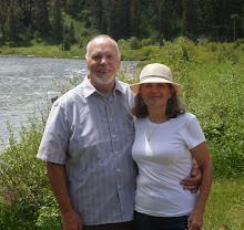
Our destination on this day was the top of Mt Washington in New Hampshire. We invited good friends, Tom and Dayle, to join us. Traveling on back roads, as we are likely to do, we happened by a covered bridge on the trip out and Hurricane Mountain Road on our return trip. Mount Washington was awesome, but it's not the only memory from that day.
Tom and Dayle at the Porter-Parsonsfield Historical Bridge, built in 1876.
One view of the 152 foot bridge.
It's a double arch bridge, which was restored in 1999. It was closed to traffic in 1960.
Another view of the bridge which spans the Ossipee River.
This end of the bridge is called the Parsonsfield-Porter Historical Bridge. It was a joint project between the two towns located on opposite sides of the river.
Mount Washington was the location where the highest wind on the earth's surface, 231 MPH was recorded on April 12, 1934.
It was a rare, mostly clear day with winds only gusting at 50 MPH. It still felt pretty cool.
Looking down at a ski area.
There are four options for getting to the top of Mt Washington, hiking, driving, taking a tour van or the train. We chose to drive and at some points, when the road was dirt and narrow, the ladies were a bit nervous. They have a long list of vehicles which are not allowed to drive it, because of the steep grade.
The cog wheel that pulls the train up the mountain.
The train starting it's trip back down.
This is a sign on Hurricane Mountain Road. For comparison, the grades on the road up Mt Washington average 12%. We paused, took this picture, put the car in low gear and enjoyed the ride down.


