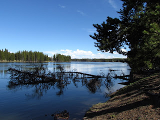
This is a longer post than usual because it covers a long, long ride we took a week ago. We drove through the park over Dunraven Pass and through Lamar Valley to Cooke City. From here we went up Beartooth Highway which reaches almost 11,000 feet. Most of it is in the Shoshone National Forest and follows along the Beartooth Mountain Range. We retraced our steps back to meet up with the Chief Joseph Highway all the way to Cody, Wyoming where it was 85 degrees. From here we turned west back through Yellowstone and back home arriving 12 hours after we departed. We had not entered the park from Cody in 23 years, when we made our first visit here. It was a tiring day but well worth it. We saw moose, grizzly bear, elk, black bear, coyote, deer and various birds but this post contains mostly pictures of the majestic scenery.


Here you can see part of the road on the Beartooth zig zagging on a narrow strip of land.

The ski lifts were still in operation. Here you can see the bottom of one and the top of another.

The winter sports enthusiast were enjoying the 34 degree temps on this day late in June.

We saw one brave, (or maybe crazy), skier start at the top of the hill on the right and work their way through between the cliffs and down out of sight. It's hard to see in the photo, but it's almost straight down. The ride was over in a flash.

The road had only been open for a few days. It was amazing how tall the walls of snow were on both sides.

The Bear Tooth.

At the bottom of the bowl shaped valley we could see a creek.

These three pictures were taken from Dead Indian Pass on the Chief Joseph. What looks like many roads is just the route winding up through the valley and then up the mountain.

The Nez Perce Trail crosses the road here.


Awesome colors further along the Chief Joseph.

Back in Yellowstone. Recent wildfire damage in shades of gray.


Our last rest stop along the Yellowstone River.

Two different ways of looking at the same scene. Beautiful either way.


No comments:
Post a Comment